NPS Willow Creek Watershed Assessment
The Blackfeet Nation is located in Northwestern Montana and covers an area of 1,525,712 acres. The reservation covers most of Glacier County and extends southward into Pondera County. The reservation lies on the east slope of the Lewis Range of the Rocky Mountains. It is bordered by Canada to the north, the Lewis and Clark national forest to the south, and Glacier National Park to the west.
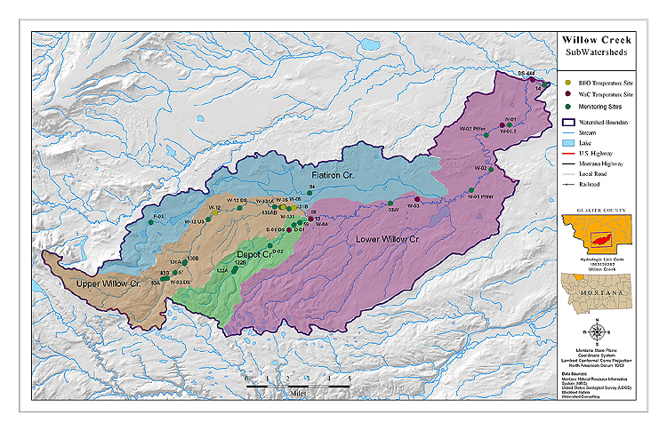
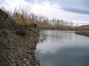
The Willow Creek drainage flows west to east from its headwaters in the foothills east of Glacier National Park, between the Cut Bank and Milk River Drainages. The watershed is entirely within the Marias River Basin and the Northwestern Glaciated Plains EcoRegion (DEQ 2006).
The watershed drains an area of 92,600 acres (Blackfeet Environmental Office (BEO) 2007) and its three main water bodies are Willow Creek, Depot Creek and Flatiron Creek. These streams originate in the foothills east of Glacier National Park and are first, second and third order streams. Primary land uses in the watershed vary from recreational and low density cattle grazing in the upstream reaches and headwaters to residential, commercial, and wastewater treatment closer to Browning. Downstream of Browning, land use is dominated by ranching and agriculture.
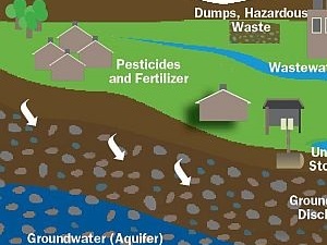
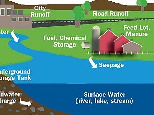
The Blackfeet Environmental Office determined that three streams in the watershed were impaired, namely Depot Creek, Flatiron Creek and Willow Creek. Water quality concerns are related primarily to nutrients, coliform and sediment as influenced by agriculture, urban runoff and wastewater treatment in the watershed (BEO 2006). This project was implemented as part of the Environmental Protection Agency (EPA) and Blackfeet Environmental Office efforts to define and quantify the impairment of these streams within the Blackfeet Reservation. Both agencies are currently working together to develop a water quality restoration plan for the Reservation.
PDF - 2 MB
Appendix B Criteria for Remote Assessment
PDF - 16 KB
Appendix C Nutrient Standards Criteria
PDF - 12 KB
Appendix A Maps

Willow Creek and Surrounding Watersheds
Willow Creek Watershed Listed Segments
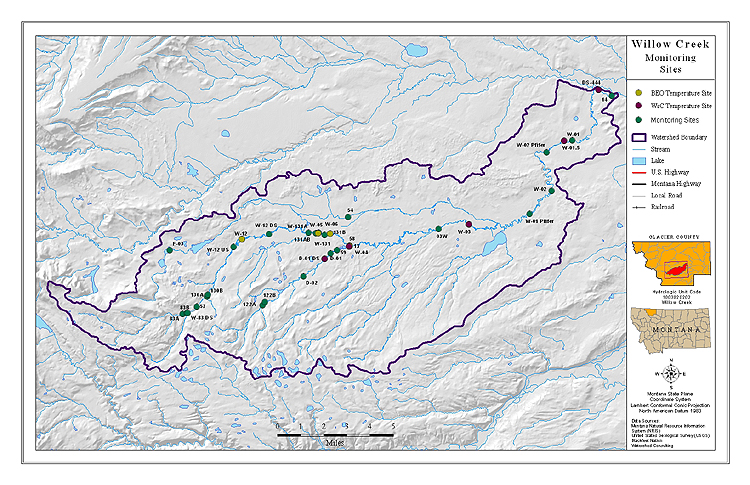
Willow Creek Watershed Temperature and Monitoring Sites
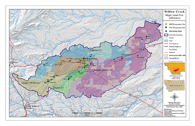
Willow Creek Watershed Land Use

Willow Creek Watershed Land Use
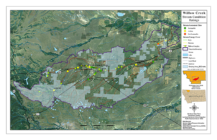
Willow Creek Watershed Stream Condition Ratings
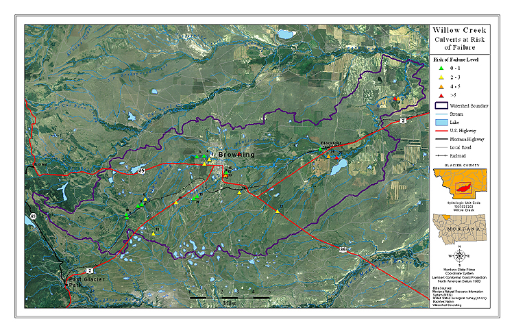
Willow Creek Watershed Culverts At Risk of Failure
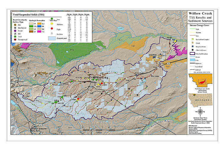
Willow Creek Watershed TSS Results
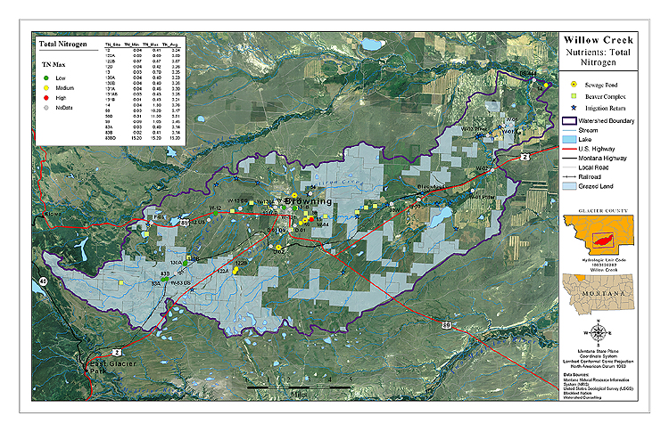
Willow Creek Watershed TN Results
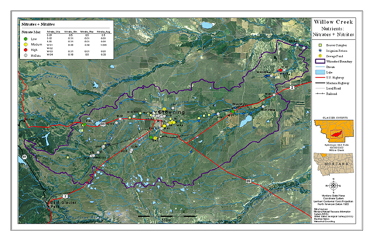
Willow Creek Watershed Nitrates-Nitrites Results
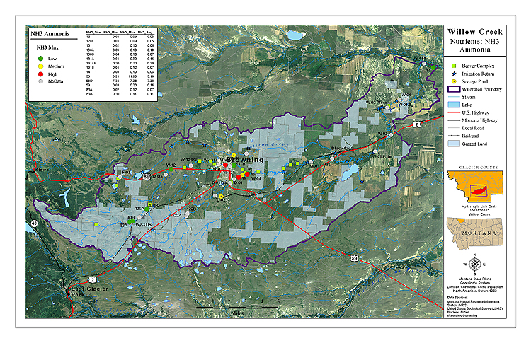
Willow Creek Watershed Ammonia Results
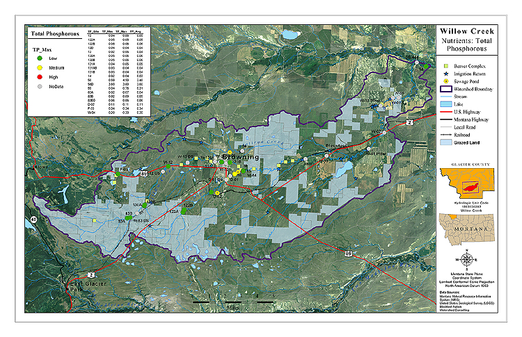
Willow Creek Watershed Total Phosphorous Results
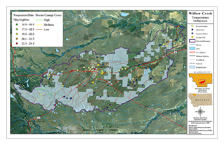
Willow Creek Watershed Temperature Influences
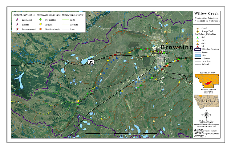
Willow Creek Watershed Restoration Priorities West

Willow Creek Watershed Restoration Priorities East
Current Events
Non-Point Source Current Events
Guidance Documents
Non-Point Source Guidance Documents
Non-Point Source Future
Blackfeet Environmental Non-Point Source Future
Contact the Blackfeet Non-Point Source Program
beo.director@gmail.com
62 Hospital Drive, PO Box 2029
Browning, Montana, USA
406-338-7421
406-338-7451 fax